
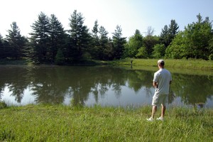
Adams Lake State Park
47-acre lake with boat ramp. Electric motors only.
The adjoining Adams Lake State Nature Preserve has two short loop trails for approximately 1/2- mile total hiking. Both are considered easy hikes. The Prairie Dock Trail is yet another example of small prairie openings common in Adams County. The Post Oak Trail features a short hike through an oak-hickory forest.
14633 State Route 41
West Union, Ohio 45693
Directions/Map
Website for Adams Lake State Park

Brush Creek State Forest
Located in the unglaciated hill country of south central Ohio, Brush Creek State Forest was established in 1928 with the acquisition of 285 acres of land. This and other early land acquisitions were originally part of Shawnee State Forest. As acreage and distances grew, the need to form a separate state forest unit became apparent in order to properly manage these scattered land holdings. In the early 1950s, a new state forest was formed and drew its name from a major stream in the area known as Scioto Brush Creek. A forest headquarters and service center was established along State Route 73 about one mile west of the village of Rarden in western Scioto County, and presently remains at that site.
Brush Creek State Forest Map: https://ohiodnr.gov/static/documents/forestry/maps/brushcreek.pdf
13291 U.S. Highway 52
West Portsmouth, Ohio 45663
Directions/Map
(740) 858-6685
Website for Brush Creek State Park

Edge of Appalachia Preserve in Adams County
The Edge of Appalachia Preserve is a privately owned 20,000 acre nature preserve that is co – owned and managed by The Cincinnati Museum Center and The Nature Conservancy of Ohio. The Edge of Appalachia Preserve offers limited opportunity for public access for deer hunting in an area totaling over 2,400 acres of preserve property. The Edge is located approximately seven miles east of West Union, Ohio. Details of the hunting opportunity can be found online at https://www.nature.org/en-us/get-involved/how-to-help/places-we-protect/edge-of-appalachia-preserve-system/ in the hunting section.
The deer hunting permit applications for the upcoming deer season in Ohio are available ONLINE ONLY and can be found here: nature.org/edgeofappalachia. The terrain at the preserve is rough, heavily forested, and mountainous, with steep hillsides and ravines. No ATV’s are permitted; hunters must hike into the area. Only a small portion of the preserve is open for this special permit only hunting and only a limited number of permits are given out each deer season. This is to maintain the quality hunting experience and to limit the number of hunters to avoid conflicts. The hunting area is remote, and hunters should be in good physical condition. Permits are required to hunt the preserve and are issued on a first come, first serve, basis through the online application system. Permits are typically made available online in mid-August and remain available until early January or until they are all issued. Permits are available, in limited number, for both non-residents and to Adams County residents. Hunters should check the website or may call the Edge of Appalachia Preserve field office at (937) 544-2880 and select extension 16 for additional information.
4274 Waggoner Riffle Road – Eulett Center
West Union, Ohio 45693
Directions/Map
(937) 544-2880
Website for Edge of Appalachia Preserve

Ohio Brush Creek Public Access
Public access on Ohio Brush creek is at the bridge at St. Rt. 73, at Serpent Mound, and at the St. Rt. 348 Bridge over Ohio Brush Creek, and the St. Rt 125 bridge over Ohio Brush Creek. Public access is also at the Edge of Appalachia’s Creeks Bend access and at the Mackenzie Run boat ramp, both on Waggoner Riffle Road. The Ohio Brush Creek Boat Ramp on U.S. 52 east of Manchester is at the mouth of Brush Creek at the Ohio River.
Click here for a map to access points on the southern portion of Ohio Brush Creek.
Website for Ohio Brush Creek public access

Ohio River Island National Wildlife Refuge
The Ohio River Islands National Wildlife Refuge conserves the ‘wild Ohio’ within one of our nation’s busiest inland waterways. Established in 1990, the refuge extends along 362 miles of the upper Ohio River with 22 scattered islands and three mainland properties. The refuge works to protect wildlife and habitats native to the Ohio River and its floodplain. Migratory birds and endangered freshwater mussels are among the important wildlife emphasized on the refuge. The two Manchester Islands are apart of this refuge.
Manchester, Ohio 45144
Directions/Map
Website for Ohio River Island National Wildlife Refuge

Riverhills Whitetail
Riverhills Whitetail is a hunting service in deer rich Adams County, Oh. Featuring a four bedroom cabin with 2 baths, stove microwave, refrigerator, and barbeque grill on back porch sitting on 114 private acres adjoining the 63,000 acre Shawnee State Forest near the Ohio River. Opening in fall of 2014 a new three bedroom, full bath and equipped kitchen available for summer rentals and spring turkey season. Riverhills Whitetail is where the big Gary Stevens typical buck was harvested. Interested parties should book reservations soon. Contact Larry Baldwin at (937) 549-4433. www.RiverhillsWhitetail.com
1228 John Shelton Rd
Manchester, Ohio 45144
Directions/Map
Website for Riverhills Whitetail

The Real McCoy Outdoors
Hunting and guide service on 8,000 acres of private property in Adams County owned by the McCoy family. Hunting leases for deer and turkey and hunting cabin rentals.
6 North Main Street
Peebles, Ohio 45660
Directions/Map
Website for The Real McCoy

Shawnee State Forest
From their website: “Located in the Appalachian foothills near the banks of the Ohio River, Shawnee State Park is nestled in the 63,000-acre Shawnee State Forest. Once the hunting grounds of the Shawnee Indians, the region is one of the most picturesque in the state, featuring erosion-carved valleys and wooded hills. The rugged beauty of the area has earned it the nickname ‘The Little Smokies.’ “
Shawnee State Forest is along the border of Adams & Scioto Counties and has many quiet gravel roads – excellent for mountain bike trips.
There are several hiking trails including a section of the North County Trail that goes through the Shawnee Wilderness Area. The Buckhorn trail, a seven mile bridle & hiking trail takes hikers into the heart of the wilderness area. The Cabbage Patch Trail also leads into the interior of the wilderness area can be accessed off Lower Twin Creek Road. The trails range from moderate to strenuous. Hikers may encounter remains of old sandstone quarries active during the late 1800’s.
Shawnee State Forest Map: https://ohiodnr.gov/static/documents/forestry/maps/shawnee.pdf
4404 State Route 125
Portsmouth, Ohio 45663
Directions/Map
(740) 858-6652
Website for Shawnee State Forest
Tranquility Wildlife Area
Tranquility Wildlife Area is located 16 miles south of Hillsboro on State Route 770. County Road 100 (Old State Route 32) runs along the southern boundary of the area.
Shooting Range: https://ohiodnr.gov/go-and-do/plan-a-visit/find-a-property/tranquility-wildlife-area-shooting-range
St. Rt. 770 & Old St. Rt. 32
Peebles & Seaman, Ohio
Directions/Map
Website for Shawnee State Forest