
Adams Lake State Park
47-acre lake with boat ramp. Electric motors only.
The adjoining Adams Lake State Nature Preserve has two short loop trails for approximately 1/2- mile total hiking. Both are considered easy hikes. The Prairie Dock Trail is yet another example of small prairie openings common in Adams County. The Post Oak Trail features a short hike through an oak-hickory forest.
14633 State Route 41
West Union, Ohio 45693
Directions/Map
Website for Adams Lake State Park

Buckeye Trail
Follow the Blue Blazes – For nearly 1444 miles, the Buckeye Trail winds around Ohio, reaching into every corner of the state. From a beachhead on Lake Erie near Cleveland, to an hilltop overlooking the Ohio River in Cincinnati, a hiker can experience a little of all that Ohio has to offer. Several sections of the Buckeye Trail winds though Adams County, please be sure to hike them all.
Toll-Free: 1-800-OHIO200
Website for Buckeye Trail

Chaparral Prairie State Nature Preserve
A blackjack-post oak prairie opening with outstanding summer prairie wildflowers and butterflies. This is an outstanding cedar barren prairie with post and blackjack oak. It supports one of the most extensive populations of rattlesnake-master in the state. Prairie dock and spiked blazing-star are also unusually abundant at this site. Eleven state-listed species have been recorded from the preserve including spider milkweed, prairie false indigo, pink milkwort and Carolina buckthorn. Little bluestem is the dominant prairie grass. Several rare lepidoptera, such as Edward’s hairstreak butterfly, have been reported from this preserve.
The 3/4-mile Hawk Hill Loop Trail that winds through the prairie features a brilliant display of late summer wildflowers. Considered an easy hike, the prairie is best viewed during July and August. The fire break trail around the perimeter of the preserve adds another mile of hiking.
209 Hawk Hill Road
West Union, Ohio 45693
Directions/Map
Website for Chaparral Prairie State Nature Preserve

Davis Memorial State Nature Preserve
This 88-acre nature preserve, set in an area of exceptional scenic beauty, is of interest primarily to geologists and botanists. The preserve contains an impressive geologic fault, dolomite cliffs, a cave, and a diverse flora. There are two richly forested hiking trails. Diverse site with rare species and excellent spring wildflowers. Davis Memorial Preserve is an outstanding geological as well as botanical natural area. There is a cave, Cedar Fork Cave, and occasional sinkholes in the preserve as well as excellent Silurian dolomite cliffs. Both Greenfield dolomite and Peebles dolomite are exposed. Ohio black shale occurs on the tops of the knobs. An impressive fault, causing vertical displacement of 30 feet, exposes adjacent cliffs of Greenfield and Peebles dolomite. A classic sinkhole occurs along the Buckeye Trail at the south end of the preserve. The dolomite cliffs provide habitat for white cedars and sullivantia. American aloe, dwarf hawthorn, hairy wing-stem, side-oats gramma grass, and purple coneflower are found in the prairie openings. Other significant species present include tall larkspur, limestone Adder’s-tongue fern, narrow-leaved bluecurls, and Walter’s violet.
This preserve contains two loop trails approximately one-half mile each, connecting with the Buckeye Trail for a total of two miles of hiking. Good year round hiking, the trails vary from easy to moderate. Hikers will see a display of spring wildflowers, geological formations, and fall colors.
2715 Davis Memorial Rd
Peebles, Ohio 45660
Directions/Map
Website for Davis Memorial State Nature Preserve

Edge of Appalachia Preserve System
The Richard & Lucile Durrell Edge of Appalachia Preserve is a 20,000-acre nature preserve in Adams County that has over 1,100 plant species as well as striking geological features like cliffs and promontories and is home to over 100 rare plants and animals. The preserve protects forested and prairie habitats, including five sites that are designated National Natural Landmarks. It is the largest privately owned natural area in Ohio and is administered jointly by the Cincinnati Museum Center and The Nature Conservancy. The Preserve has 27 miles of hiking on five public hiking trails, a picnic area, and two canoe & boat access sites to Ohio Brush Creek. The Eulett Center on Waggoner Riffle Road is open for meetings and conferences.
Hiking & Preserve links:
Buzzardroost Rock Trail: https://www.nature.org/en-us/get-involved/how-to-help/places-we-protect/edge-of-appalachia-buzzardroost-rock-trail/
Wilderness Trail: https://www.nature.org/en-us/get-involved/how-to-help/places-we-protect/edge-of-appalachia-the-wilderness-trail/
Lynx Prairie Trail: https://www.nature.org/en-us/get-involved/how-to-help/places-we-protect/edge-of-appalachia-lynx-prairie-trail/
Joan Portman Trail/Buckeye Trail/Canoe launch: https://www.nature.org/en-us/get-involved/how-to-help/places-we-protect/joan-jones-portman-trail-and-dr-george-rieveschl-jr-creeks-bend-overlook/
Cedar Falls Trail: https://www.nature.org/en-us/get-involved/how-to-help/places-we-protect/edge-of-appalachia-cedar-falls-trail/
4274 Waggoner Riffle Road – Eulett Center
West Union, Ohio 45693
Directions/Map
(937) 544-2880 – ext. 11
Website for Edge of Appalachia Preserve System

The Arc of Appalachia Preserve in Adams County
The mission of the non-profit Arc of Appalachia (the “Arc”) is to protect the beauty, balance, & biodiversity of wildlands in Appalachian Ohio. Since 1995, the Arc has been committed to creating new nature preserves in Ohio, several of which are located in Adams County. Seven of these preserves are open to the public daily. These protected lands enable visitors to connect with the natural world and serve as a gateway to some of Ohio’s finest wilderness experiences.
Hiking & Preserve links:
Rock Run Preserve: https://www.arcofappalachia.org/rock-run
Chalet Nivale: https://www.arcofappalachia.org/chalet-nivale
Kamama Prairie: https://www.arcofappalachia.org/kamama-prairie
Plum Run Prairie: https://www.arcofappalachia.org/plum-run
Chaparral Prairie: https://www.arcofappalachia.org/chaparral-prairie
Ohio River Bluffs: https://www.arcofappalachia.org/ohio-river-bluffs
Quiverheart Preserve: https://www.facebook.com/profile.php?id=100076885446508
7629 Cave Rd.
Bainbridge, Ohio 45612
Directions/Map
(937) 365-0101
Website for The Arc of Appalachia Preserve

Johnson Ridge State Nature Preserve
208 acres of wilderness with summer prairie wildflowers. The preserve sets alongside an Amish community.
Johnson Ridge State Nature Preserve
West Union, Ohio 45693
Directions/Map
Website for Johnson Ridge State Nature Preserve

Ohio River Island National Wildlife Refuge
The Ohio River Islands National Wildlife Refuge conserves the ‘wild Ohio’ within one of our nation’s busiest inland waterways. Established in 1990, the refuge extends along 362 miles of the upper Ohio River with 22 scattered islands and three mainland properties. The refuge works to protect wildlife and habitats native to the Ohio River and its floodplain. Migratory birds and endangered freshwater mussels are among the important wildlife emphasized on the refuge. The two Manchester Islands are apart of this refuge.
Manchester, Ohio 45144
Directions/Map
Website for Ohio River Island – KY Fish & Wildlife
Website for Ohio River Island – U.S. Fish & Wildlife

Robert A. Whipple State Nature Preserve
270 acres filled with Dolomite cliffs, slump blocks, sinkholes and good spring wildflowers. Pull off parking and a sign are present. The preserve has a moderate 1-3/4 mile hike among the Ohio River hills. During late fall, after the leaves are gone, hikers can view the Ohio River valley.
1194 State Rte 247 – The east side of St Rt 247, approximately 1 mile north of Rt 52
Manchester, Ohio 45144
Directions/Map
Website for Robert A. Whipple State Nature Preserve

Serpent Mound
Serpent Mound is one of the few effigy mounds in Ohio. It is the largest and finest serpent effigy in the United States. The museum contains exhibits on the mound and the geology of the surrounding area, known as the Serpent Mound crypto explosion structure. It is located on State Route 73 six miles north of State Route 32. It is operated and maintained by the Ohio Historical Society. Serpent Mound is open year round, although hours vary with the seasons. Museum hours also vary. There are special hours for schools and other groups by appointment.
Features a short, 1/4-mile, trail that winds downhill to the Brush Creek valley. Considered a moderate hike, the trail is at its best during the early spring when Trilliums cover the hillsides.
Please call (937) 587-2796 for more information.
Serpent Mound State Memorial
3850 State Route 73 (5 miles NW of Locust Grove on State Route 73)
Peebles, Ohio 45660
Directions/Map
1-800-752-2757
Website for Serpent Mound

Shawnee State Forest
From their website: “Located in the Appalachian foothills near the banks of the Ohio River, Shawnee State Park is nestled in the 63,000-acre Shawnee State Forest. Once the hunting grounds of the Shawnee Indians, the region is one of the most picturesque in the state, featuring erosion-carved valleys and wooded hills. The rugged beauty of the area has earned it the nickname ‘The Little Smokies’.
Shawnee State Forest is along the border of Adams & Scioto Counties and has many quiet gravel roads – excellent for mountain bike trips.
There are several hiking trails including a section of the North County Trail that goes through the Shawnee Wilderness Area. The Buckhorn Trail, a seven mile bridle & hiking trail takes hikers into the heart of the wilderness area. The Cabbage Patch Trail also leads into the interior of the wilderness area can be accessed off Lower Twin Creek Road. The trails range from moderate to strenuous. Hikers may encounter remains of old sandstone quarries active during the late 1800’s.
4404 State Route 125
Portsmouth, Ohio 45663
Directions/Map
(740) 858-6652
Website for Shawnee State Forest
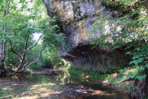
Shoemaker State Nature Preserve
Adams County’s newest preserve featuring natural arches, dolomite cliffs and slump blocks. This preserve protects a tributary of the Scioto Brush Creek and includes a 1.5mile hiking trail that concludes with a loop. Hikers will see geological formations, spring wildflowers, and a large natural arch. The trail follows Cedar Fork a tributary of Scioto Brush Creek and is considered a moderate hike.
165 Pine Gap Rd
Peebles, Ohio 45660
Directions/Map
Website for Shoemaker State Nature Preserve